Exposure Model for residential buildings with five or more stories in Santiago, Chile, for use in regional seismic risk assessments. The catalog consists of 9,793 individual residential buildings. The attributes of each building in the model encompass its georeferenced footprint, height, number of stories, soil properties ($V_{s30}$ and $T_g$), number of dwellings and households, number of inhabitants, year of construction, and design era (pre- or post-2010); merging structural, geotechnical, and social aspects of the building stock as of 2023. Multiple open-source datasets were utilized to create this exposure model, the year of this exposure model is 2023.
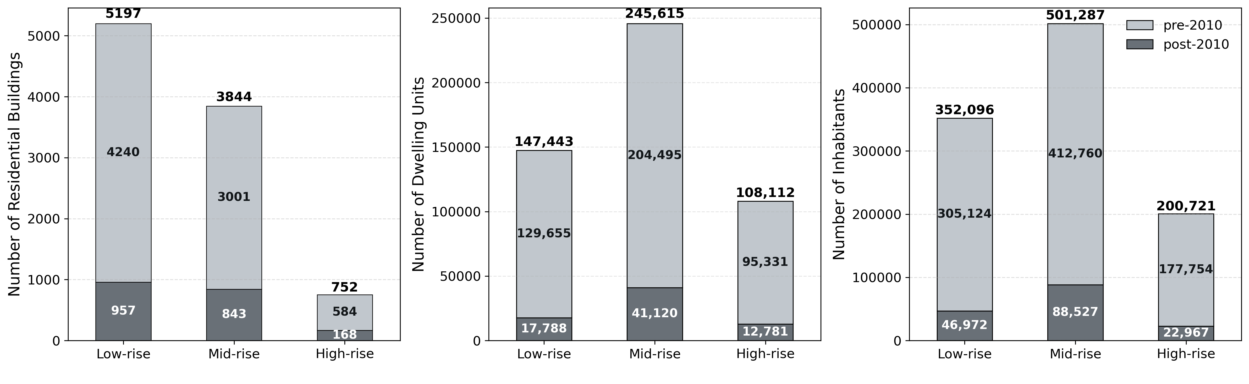
Figure 1: Disaggregation of number of buildings, dwelling units and inhabitants by height-based typology (low-rise, mid-rise and high-rise) and design era (pre- and post-2010).